Project
See Seven States
Rock City is a legendary piece of Americana in the Deep South. Nestled in Tennessee’s famous Lookout mountain — although technically just over the border in Georgia — is a lovely series of trails and bridges and caves and crevices and cliffs with a slightly surreal black-light gnome theme.
I visited as a child, and I’ve visited as an adult. The sense of wonder is differently flavored at different ages, but the experience has always been memorable and delightful. The famous signs and painted barn roofs and birdhouses shouting “See Rock City” may be advertising, but it’s honest advertising. Rock City is well worth seeing.
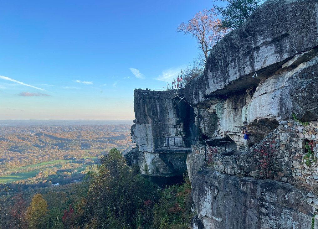
One of the most famous spots in the attraction is Lover’s Leap, a beautiful clifftop view from which one can See Seven States.
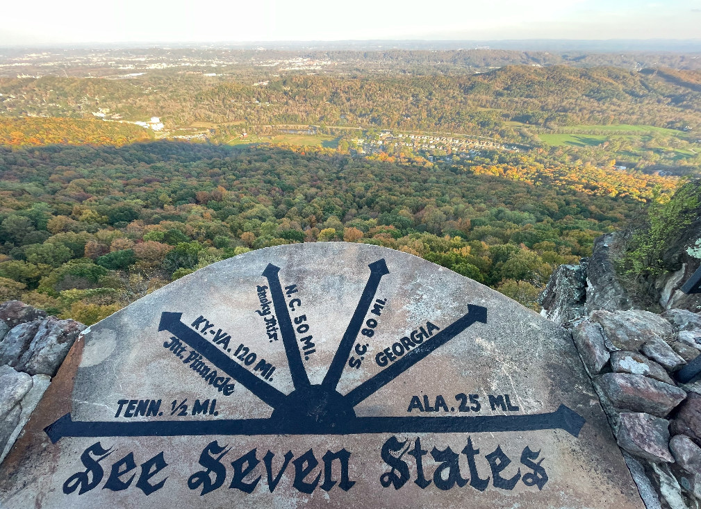
Can you see seven states? Georgia is straightforwardly visible; Lover’s Leap is in Georgia. Tennessee is visible, and in fact within a few minutes’ walking distance. Alabama is close. It’s twenty-five miles according to the plaque at the cliff edge, which is in principle not a heavy lift from a high cliff.
Kentucky? Virginia? North and South Carolina? Hmm.
When I was a kid, looking into the distance from Lover’s Leap, I wondered which areas corresponded to which state. Was that Virginia in the distance?
Now that I’m an adult, I know about things like the United States Geological Survey and their 90 m resolution grid of elevation data. In principle, it’s easy to draw a line from the elevation grid point located at Lover’s Leap to the surrounding grid points throughout the southern United States. If that line is not blocked by a nearer grid square, the end point is indeed within your viewshed. You do have to account for the curvature of the earth. You should also account for the slightly variable atmospheric refraction, but in this case the effect is minimal enough so as to make no difference.
The result? I am sorry to say that you can see three states from Lover’s Leap: Georgia, Tennessee, and if haze allows, North Carolina.
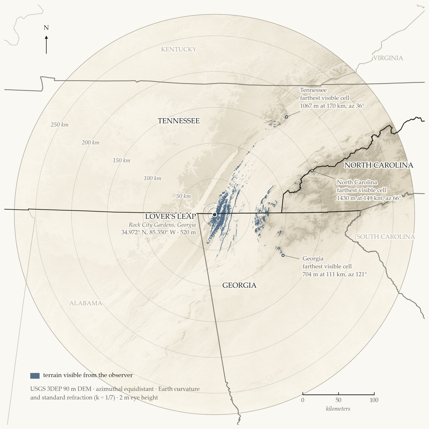
Alabama is indeed very nearby, but the entire state is blocked from view by Lookout Mountain itself. South Carolina is blocked by the higher elevations of North Carolina and Georgia. Kentucky is blocked largely by the more northerly segments of the mountain range you’re standing on. Virginia is mostly geometrically intractable simply because the Earth is round.
Alas, the See Seven States legend is indeed a legend.
But the South is a place of mystery, of moonshine, of mountains that are older than the trees. If you look carefully enough, you can see the soul of those seven states. At Rock City, that magic more than suffices.
The tables and notes below are machine-generated.
Per-state results
| state | visible | nearest visible | farthest visible | highest visible |
|---|---|---|---|---|
| Tennessee | yes | 1.3 km | 170 km | 1,642 m |
| Georgia | yes | 0 km | 111 km | 1,255 m |
| North Carolina | yes | 97 km | 149 km | 1,688 m |
| Alabama | no | — | — | — |
| South Carolina | no | — | — | — |
| Kentucky | no | — | — | — |
| Virginia | no | — | — | — |
Distances are from the observer; the observer stands in Georgia, so its nearest visible cell is the ground underfoot. The highest visible cell in Tennessee (1,642 m) is in the Cherokee National Forest, in Georgia (1,255 m) the Cohutta Wilderness, and in North Carolina (1,688 m) the Nantahala National Forest.
Sensitivity
Visible cells per state, across the refraction coefficient k and observer eye height h. The set of visible states does not change in any scenario: strong refraction roughly doubles the North Carolina count, and a 30 m eye height — about a ten-story building — does not lift Alabama, South Carolina, Kentucky or Virginia above zero.
| scenario | TN | GA | NC | AL | SC | KY | VA |
|---|---|---|---|---|---|---|---|
| Standard (k = 1/7, h = 2 m) | 48,728 | 54,257 | 646 | 0 | 0 | 0 | 0 |
| No refraction (k = 0, h = 2 m) | 44,062 | 52,212 | 403 | 0 | 0 | 0 | 0 |
| Strong inversion (k = 0.25, h = 2 m) | 53,020 | 55,804 | 1,007 | 0 | 0 | 0 | 0 |
| Generous height (k = 1/7, h = 30 m) | 54,678 | 60,227 | 745 | 0 | 0 | 0 | 0 |
The data files
| file | contents |
|---|---|
| state_results.json | Per state: visible yes/no, cell counts, and the nearest, farthest and highest visible cell (latitude, longitude, distance, elevation, bearing). |
| sensitivity.json | Visible-cell counts per state for each of the four scenarios in the table above. |